- Published on
Extract OSM data with Osmium
- Authors

- Name
- YuChun Tsao
The previous article (import-osm-data-into-postgis-with-osm2pgsql) introduces how to import OSM data into PostGIS through osm2pgsql. In this article, I will extract OSM with Osmium and import customized osm.pbf into PostGIS.
Environment
- Ubuntu 18.04
- CMake 3.24.1
Installation
Follow the official documentation to install: Osmium Command Line Tool
Download OSM data
Download from geofabrik
In this article, I will use taiwan-latest.osm.pbf for the next step.
You can use osmium fileinfo to inspect your osm.pbf file
osmium fileinfo taiwan-latest.osm.pbf
File:
  Name: taiwan-latest.osm.pbf
  Format: PBF
  Compression: none
  Size: 114332934
Header:
  Bounding boxes:
    (118.1036,20.72799,122.9312,26.60305)
  With history: no
  Options:
    generator=osmium/1.14.0
    osmosis_replication_base_url=http://download.geofabrik.de/asia/taiwan-updates
    osmosis_replication_sequence_number=3577
    osmosis_replication_timestamp=2023-01-14T21:21:25Z
    pbf_dense_nodes=true
    pbf_optional_feature_0=Sort.Type_then_ID
    sorting=Type_then_ID
    timestamp=2023-01-14T21:21:25Z
You can use
-eoption to show more information about the pbf.
Creating geographic extracts
Extract with bounding box
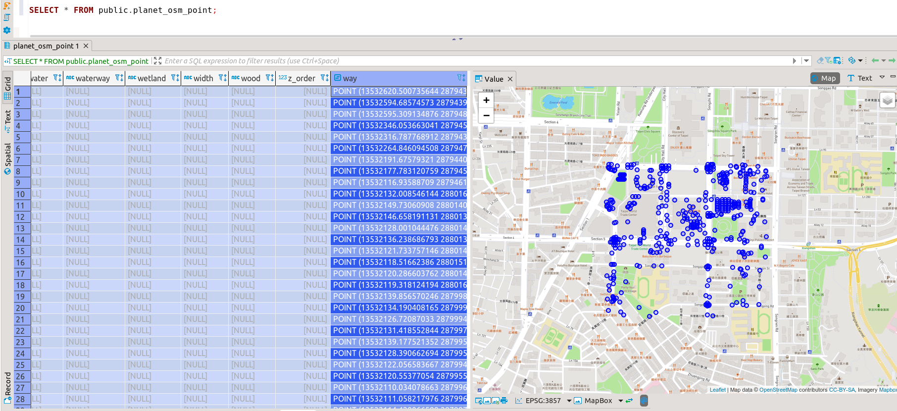
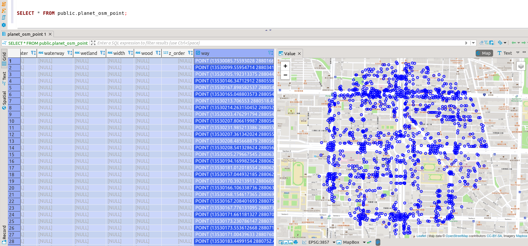
osmium extract \
  -s simple \
  -b 121.561,25.030,121.568,25.036 \
  taiwan-latest.osm.pbf \
  -o bounding_box_output.pbf
-s,--strategy
Osmium offers three different extract strategiessimple,complete_ways(default) andsmart. Their results are different, more or less OSM objects will be included in the output.
More information about extract strategy can read manual of Osmium.
Extract with OSM boundary
You can find relation id from OpenStreetMap.
In my case, I typed taipei keyword in search bar to find the relation id of Taipei City as 1293250.
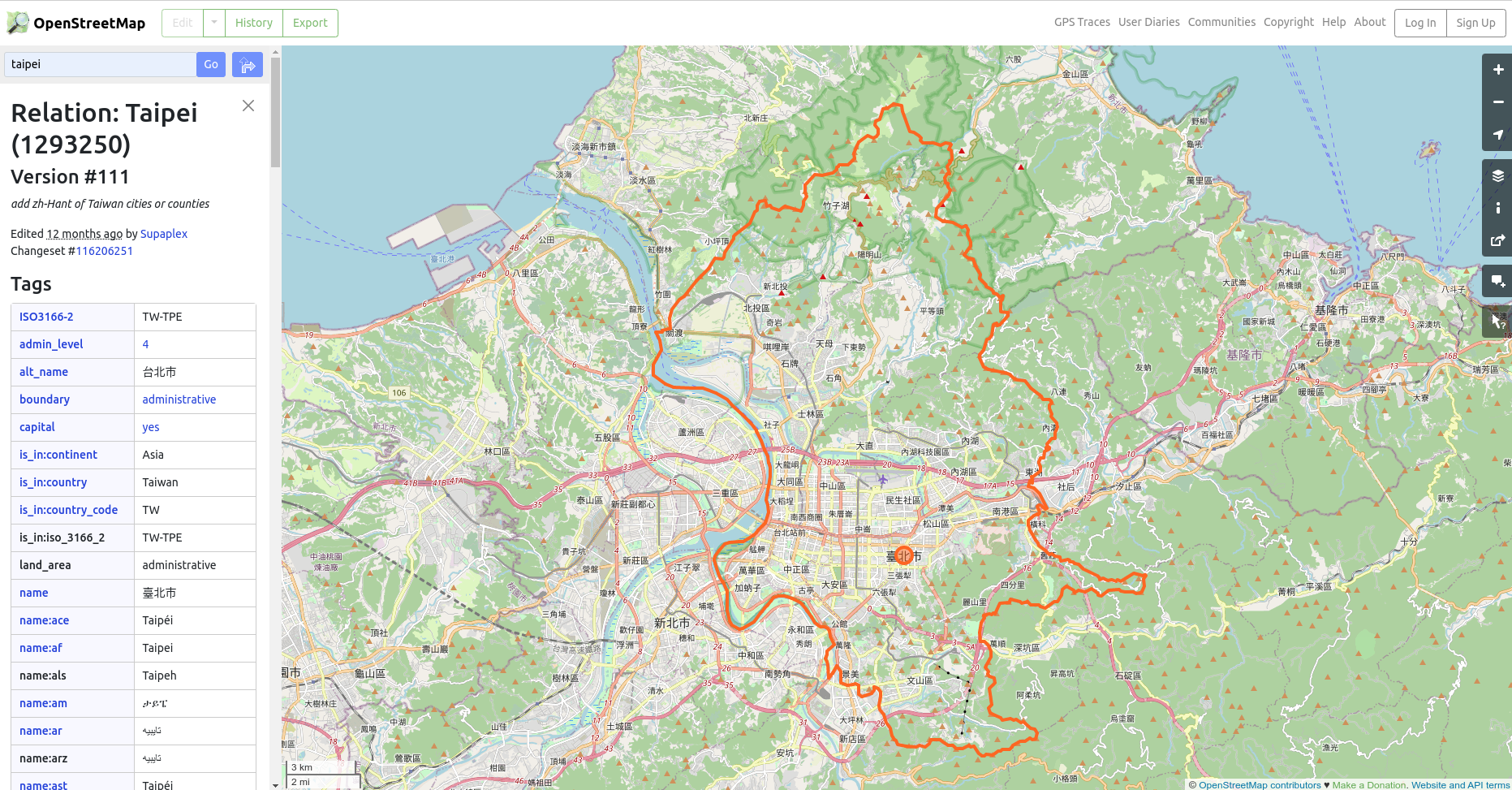
Extract the boundary through the relation id of Taipei City.
osmium getid -r -t taiwan-latest.osm.pbf r1293250 -o taipei-boundary.osm
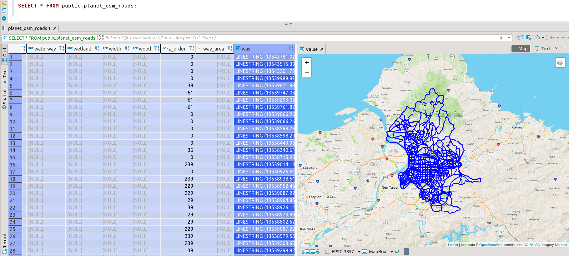
Then extract the pbf file of Taipei City through taipei-boundary.osm.
osmium extract -s simple -p taipei-boundary.osm taiwan-latest.osm.pbf -o boundary_output.pbf
Extract with GeoJSON
If you have geographic data in GeoJSON format also used to extract the data.
I got a circle from geojson.io as my input geojson data.
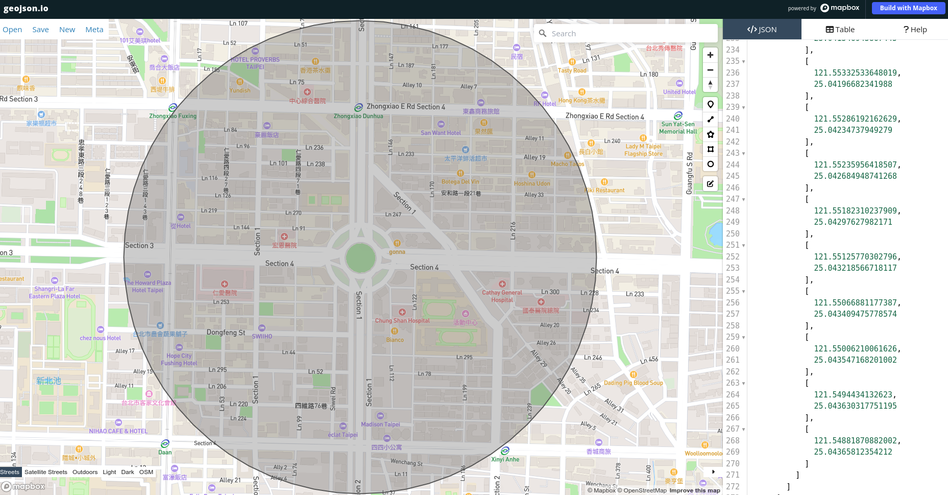
Extract data through the circle in GeoJSON format.
osmium extract -s simple -p polygon.geojson taiwan-latest.osm.pbf -o geojson_output.pbf
Several extracts with config file
The config file is in JSON format. The top-level is an object which contains at least an extracts array. It can also contain a directory entry which names the directory where all the output files will be created.
config.json
{
  "extracts": [
    {
      "output": "bounding_box_output.pbf",
      "output_format": "pbf",
      "description": "extract with bbox",
      "bbox": [121.561, 25.03, 121.568, 25.036]
    },
    {
      "output": "boundary_output.pbf",
      "description": "extract with osm boundary",
      "polygon": {
        "file_name": "taipei-boundary.osm",
        "file_type": "osm"
      }
    },
    {
      "output": "geojson_output.pbf",
      "description": "extract with geojson polygon",
      "polygon": {
        "file_name": "polygon.geojson",
        "file_type": "geojson"
      }
    }
  ],
  "directory": "./output/"
}
The output directory must exist.
Extract data with this config file.
osmium extract -s simple -c config.json taiwan-latest.osm.pbf
After execution you will be able to find the pbf in the output directory.
$ tree output
output
├── boundary_output.pbf
├── bounding_box_output.pbf
└── geojson_output.pbf

0 directories, 3 files